Ladies Mile Master Plan
Queenstown, New Zealand
The Future Growth Corridor of Queenstown
Ladies Mile represents one of the most significant and coordinated urban growth corridors in Queenstown — where infrastructure, planning, and population growth converge.
Clarke Group holds a strategic position across key landholdings within the corridor, enabling a coordinated approach to masterplanning, infrastructure delivery, and staged development over time.
A Defined Corridor of Growth
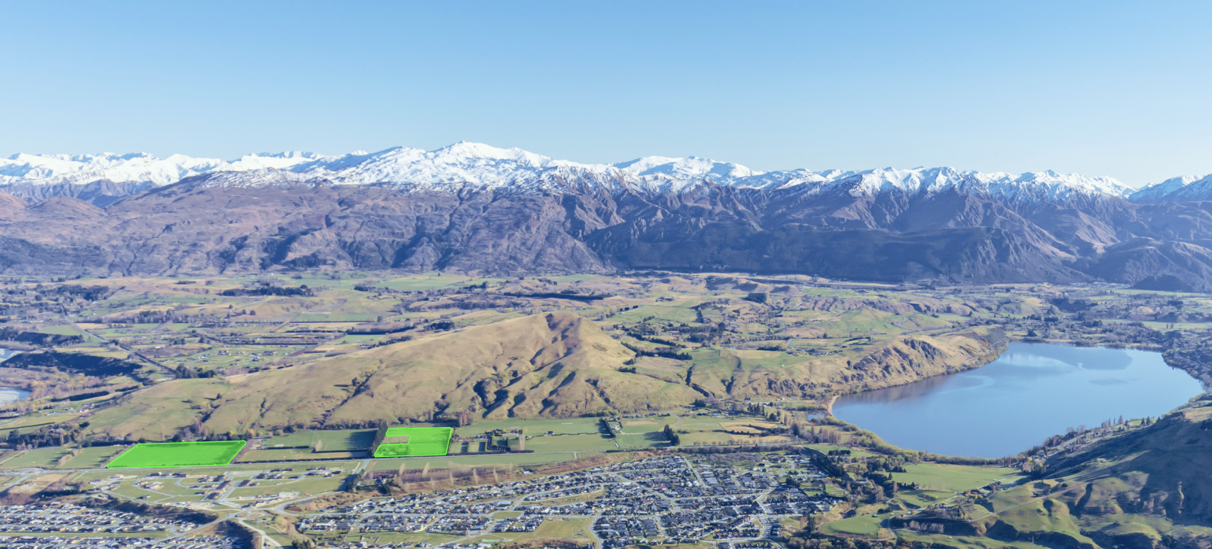
Located between Frankton and Lake Hayes, Ladies Mile was rezoned in December 2024 to enable significant long-term urban development. Clarke Group is actively working alongside key stakeholders to coordinate the planning, funding, and delivery of this infrastructure, enabling a staged and integrated rollout of development across the corridor.
As with all major growth corridors, the full realisation of this opportunity is dependent on the coordinated delivery of core infrastructure — including water, wastewater, and transport.
Clarke Group is actively working alongside key stakeholders to coordinate the planning, funding, and delivery of this infrastructure — positioning the precinct for a staged and integrated rollout of development over time.
Enabling Infrastructure & Delivery
The delivery of Ladies Mile is underpinned by coordinated infrastructure — particularly water, wastewater, and transport — requiring alignment between landowners, council, and infrastructure providers.
Clarke Group plays a key role in enabling development across the corridor through its involvement in potable water servicing.
This coordinated approach is critical to unlocking the full development potential of the Ladies Mile corridor.
01
Stakeholder Coordination
Clarke Group works closely with infrastructure providers, council, and adjoining landowners to support the coordinated rollout of services across the corridor — aligning development with broader precinct planning.
02
Infrastructure & Development Alignment
Development is aligned with infrastructure capacity and delivery timing, ensuring projects can proceed efficiently while reducing delivery risk across the precinct.
03
Staged Delivery & Sequencing
A staged approach to delivery integrates land, infrastructure, and development sequencing — enabling each phase to contribute to a cohesive and sustainable precinct over time.
Residential neighbourhood
Parcel 1
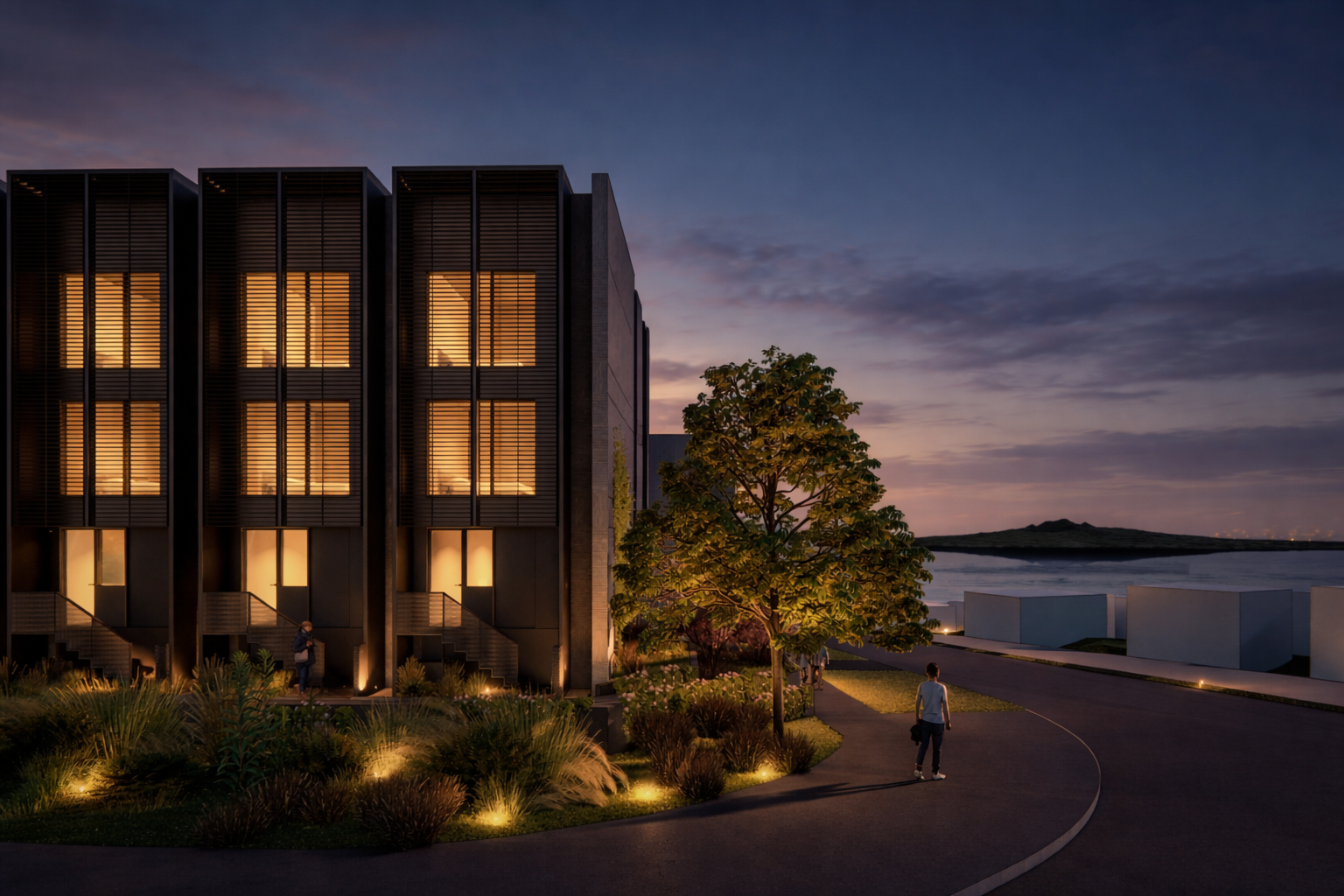
429 Frankton–Ladies Mile Highway Townhouse Masterplan
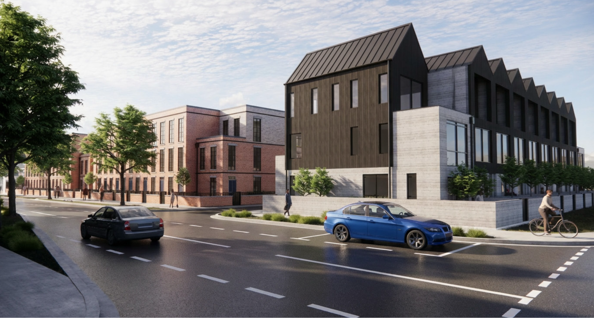
Parcel 1 represents the first major residential component of the Ladies Mile precinct, delivering a masterplanned townhouse community at 429 Frankton–Ladies Mile Highway. The scheme has been designed to respond to both immediate housing demand and long-term growth within the corridor — balancing density, outlook, and accessibility within a highly liveable environment.
Positioned within a coordinated precinct framework, the development integrates with surrounding infrastructure and supports a staged approach to delivery as the broader Ladies Mile area evolves.
- Masterplanned medium-density terrace housing
- Efficient, buildable layouts enabling staged delivery
- Integrated with wider precinct infrastructure planning
- Designed for long-term liveability and connectivity
- Aligned with Queenstown’s evolving housing demand
Commercial centre
Parcel 3
465 & 489 Frankton–Ladies Mile Highway Commercial & Local Centre
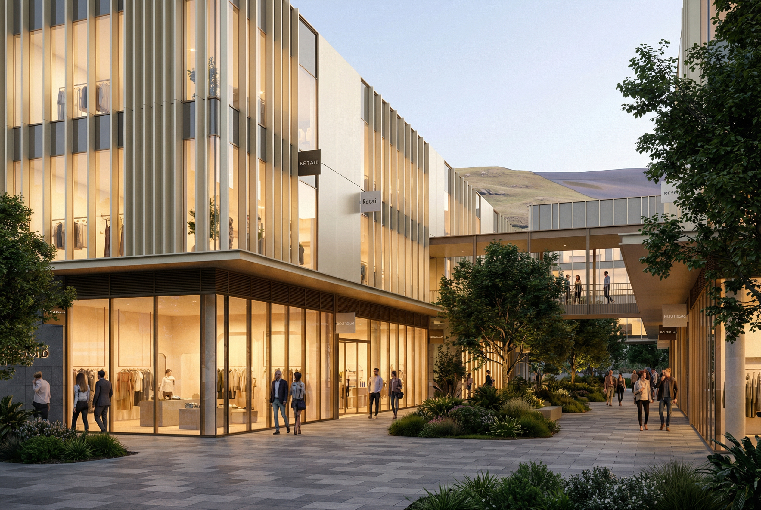
Parcel 3 forms the commercial heart of the Ladies Mile precinct, spanning 465 & 489 Frankton–Ladies Mile Highway. The development is intended to establish a local centre providing retail, service, and commercial space to support both the immediate residential catchment and the wider corridor.
Designed as an integrated and walkable destination, the centre will play a key role in shaping the identity and functionality of the precinct as it develops over time.
- Local retail and essential services supporting daily life
- Flexible commercial and service space
- Integrated with surrounding residential neighbourhoods
- Positioned to support a growing population and employment base
- A central hub contributing to a connected and activated precinct

Delivery & Consultant Team
Clarke Group leads the assembly and coordination of best-in-class consultant teams across planning, design, engineering, and delivery.
We work alongside experienced partners, supporting strong commercial oversight and disciplined execution.
This integrated approach ensures each project is led with clarity, accountability, and a consistent focus on delivery outcomes.


John Stephens
Partner
Legal and Strategic Advice


Rory Griffin
Director
Bank QS & Contract Administration


Rene Lin
Director
Senior Project Manager

Chris Drum
Associate Director
Senior Project Manager


Jonathan Ball
Director
Commercial Debt Advisor
Werner Murray
Principal planner
Planning and Strategy


Rob Stewart
Principal - otago/southland
Civil Engineer

Jason Bartlett
Director
Traffic Engineer


Chris Millman
Director
Lead Architect

Joe Murphy
Auckland Studio Chair
Lead Architect


Tim Church
Partner
Urban Design and Masterplanning

Emma Todd
Partner
Lead Landscape Architect


Luke Hallsmith
Consultant
Commercial Debt Advisor
Coordinated Delivery & Sequencing
Ladies Mile is being delivered through a coordinated, staged approach aligning development with infrastructure, market demand, and capital deployment.
By integrating land, infrastructure, and project sequencing, Clarke Group ensures each stage contributes to a cohesive and sustainable precinct.
A disciplined approach to delivery, supporting the structured evolution of the precinct over time.
A disciplined approach to delivery, ensuring each stage contributes to a cohesive and enduring precinct.
A New Community Taking Shape
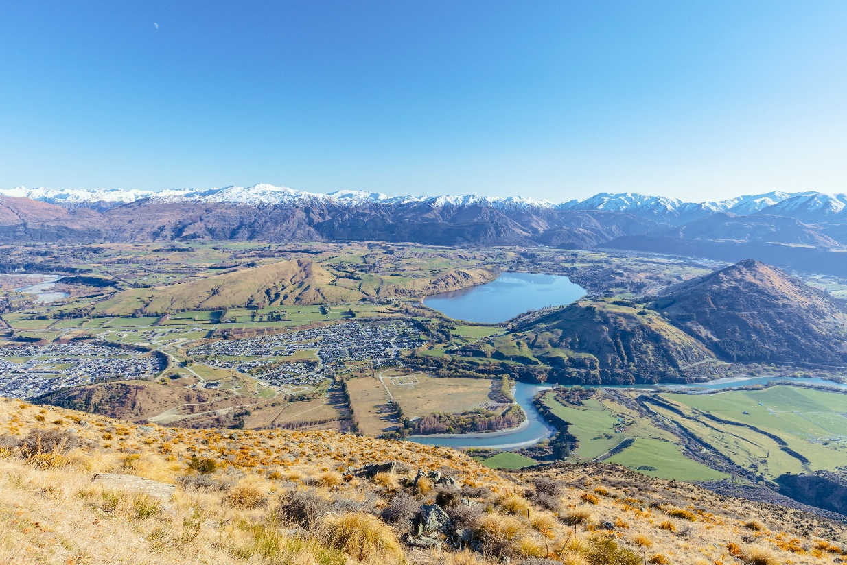
Ladies Mile is taking shape as a new urban community — integrating residential neighbourhoods, local amenity, and enabling infrastructure within one of Queenstown’s key growth corridors.
Delivered through a coordinated and staged approach, the precinct is being established as a connected and enduring urban environment over time.
Frequently Asked Questions
Queenstown has changed, and so has the way we think about building communities.
When the original consent was approved in 2024, it reflected the planning priorities of the time. Since then, the vision for Ladies Mile has evolved into creating a thriving urban neighbourhood where more people can live closer to public transport, parks, jobs and everyday services.
The Te Pūtahi Ladies Mile Plan Change came into effect in December 2024. The planning and transport work undertaken for Ladies Mile reached a clear conclusion: if we want to reduce congestion, improve public transport and create a community where people have genuine transport choices, we need the right level of density. That's what makes regular bus services viable, encourages more people to walk and cycle, and makes the best use of the significant investment being made in infrastructure.
Our updated proposal responds to that vision. It delivers more homes on land that has already been identified for urban growth, while creating a well-designed neighbourhood with quality open spaces, walkable streets and a range of housing choices for people at different stages of life.
We know Queenstown needs more homes, but it also needs better communities. We believe those two goals go hand in hand. This proposal is about creating a neighbourhood that supports families, workers, first-home buyers and future generations, while helping to deliver the transport outcomes the district has been planning for.
We haven't changed direction. We've refined our plans to better reflect Queenstown's future, making the most of a once-in-a-generation opportunity to deliver the kind of community Ladies Mile is intended to become.
The application does not rely on the existing wastewater network remaining unchanged.
Clarke Group's proposal includes a new precinct-wide wastewater rising main connecting to the Southern Corridor wastewater network via the Shotover Bridge, rather than relying on the existing localised network. Clarke Group will fund this infrastructure, with an estimated construction cost of approximately $28 million, before it is vested as public infrastructure and recovered through Development Contribution credits.
More broadly, this proposal forms part of the planned Ladies Mile infrastructure programme. Queenstown Lakes District Council's Long Term Plan identifies approximately $121 million of development-funded infrastructure investment for the Ladies Mile area, including:
• Stormwater: approximately $50.2 million
• Wastewater: approximately $34.2 million
• Water supply: approximately $29.3 million
• Local transport network: approximately $7.1 million
This infrastructure is intended to be funded through development, rather than existing ratepayers, and will not only service new neighbourhoods but also improve the resilience and capacity of infrastructure that benefits the wider community. As older assets are upgraded and new networks are constructed, existing residents will also benefit from increased system capacity and improved long-term reliability.
The programme is already underway. Construction of the first major transport improvements at the Howards Drive intersection has commenced in partnership with NZTA, with further transport and water infrastructure to be delivered alongside future development.
In addition to infrastructure investment, the proposal will also deliver approximately 4.2 hectares of new public parkland, together with walking and cycling connections, stormwater management systems and other community infrastructure as part of an integrated approach to developing Ladies Mile.
Reducing congestion is one of the key reasons the Ladies Mile Structure Plan promotes higher-density, mixed-use neighbourhoods rather than traditional suburban development.
Overall Ladies Mile has been designed as a complete community, with homes, parks, shops, schools and community facilities located within easy walking and cycling distance. That means some everyday trips may no longer need to be made by car.
Independent transport planning undertaken for the Ladies Mile Structure Plan concluded that medium and higher residential densities are essential to support frequent public transport and reduce reliance on private vehicles. Lower-density development would actually generate more traffic and make it harder to achieve the transport outcomes planned for the corridor.
Development will also be staged alongside transport infrastructure. No more than 287 homes can be occupied until key upgrades, including the signalised Stalker Road intersection, have been completed. Those requirements are proposed as consent conditions, to make sure that infrastructure keeps pace with development.
Cycling isn't being promoted as a replacement for roads. It's one part of a much broader transport strategy that combines road upgrades, public transport, walking and cycling to give people more travel choices.
The planning vision for Ladies Mile has always been to create a complete community where many everyday destinations, such as schools, parks, shops and community facilities are within easy walking or cycling distance. The aim is that short local trips don't always require getting in the car, while buses become a more attractive option for longer journeys.
Cycling infrastructure is therefore about providing choice rather than expecting everyone to ride a bike. Queenstown's growing use of e-bikes has also made cycling practical for many more people and over longer distances than would have been the case a decade ago.
This isn't Clarke Group introducing a new idea. It reflects almost a decade of planning by QLDC, Waka Kotahi and the Way to Go partnership, all of which have identified integrated public and active transport as essential to addressing long-term congestion on SH6.
The proposal delivers bus stops, pedestrian crossings, connected walking and cycling routes and secure cycle storage alongside significant road and intersection upgrades. These measures work together to reduce reliance on private vehicles while ensuring residents continue to have full vehicle access when they need it.
Some existing vegetation at 489 Ladies Mile will need to be removed as the site is prepared for development. This includes a mixture of mature and semi-mature exotic trees, shelter planting and ornamental species that were established during the site's former life as a pet lodge operation.
Removing this vegetation is a necessary first step in enabling safe public access, site infrastructure works and future development planning.
We understand that the existing trees are part of what people see when they drive along Ladies Mile today, and we don't take their removal lightly. Preparing the site carefully and responsibly is important to us, and it is the foundation for what comes next.
The landscape vision for Ladies Mile is for a genuinely green neighbourhood, that over time will have significantly more coordinated planting, canopy cover and public green space than currently.
Street tree planting, landscaped parks, green pedestrian connections and a diverse mix of native and climate-appropriate species will be established throughout the precinct, across streets, community spaces and residential frontages. Planting will draw on native trees and shrubs, flowering and seasonal specimen trees, grasses, flaxes, tussocks and groundcovers chosen for their resilience, ecological value and contribution to the character of the neighbourhood.
The same landscape design philosophy guiding the approved 429 Ladies Mile development will shape future planting across 489 Ladies Mile and the wider precinct, ensuring a consistent and cohesive approach. The aim is a lasting landscape that supports biodiversity, provides shade and amenity, and helps create a distinctive sense of place along the Ladies Mile corridor for generations to come.
The future of Ladies Mile has been one of the most publicly debated planning projects in Queenstown over the past decade. Many people have contributed time and expertise for community consultation, master planning, public submissions, hearings and independent decision-making. That process involved everyone from local residents and community associations through to Queenstown Lakes District Council, Waka Kotahi, Otago Regional Council and ultimately central government.
The outcome of that process is the Te Pūtahi Ladies Mile planning framework, which specifically provides for higher-density housing and recognises that maximising housing in appropriate locations is a key planning priority. Whether Ladies Mile should become a higher-density urban community has been extensively considered through the public planning process.
Resource consent applications are assessed on the environmental effects they generate, rather than simply the number of homes proposed. Under the Ladies Mile provisions, residential developments that comply with the planning framework are generally anticipated to proceed on a non-notified basis because the effects have already been considered through the zoning process. While our application seeks consent for some design and development matters, those relate to how the neighbourhood is delivered rather than whether higher-density housing is appropriate in this location.
Ultimately, whether this application is publicly notified is a decision for QLDC, applying the legal tests in the Resource Management Act. Council is currently obtaining independent expert advice before making that decision, and Clarke Group welcomes that independent assessment.
Explore our developments or speak with our team.